Covering the little and forgotten areas. This is a representation for those airports, all the spare info are compiled from Google, that´s why no one has to try to make it before, (no accurate textures and sizes) seasonals textures, triple autoinstaller for FSX, P3D3, P3Dv4, P3D5 and MSFS, screenshots, seasonals textures, photoreal terrain (for the field only), autogen, custom building, new ground lights and moving jetways.
sábado, 6 de octubre de 2018
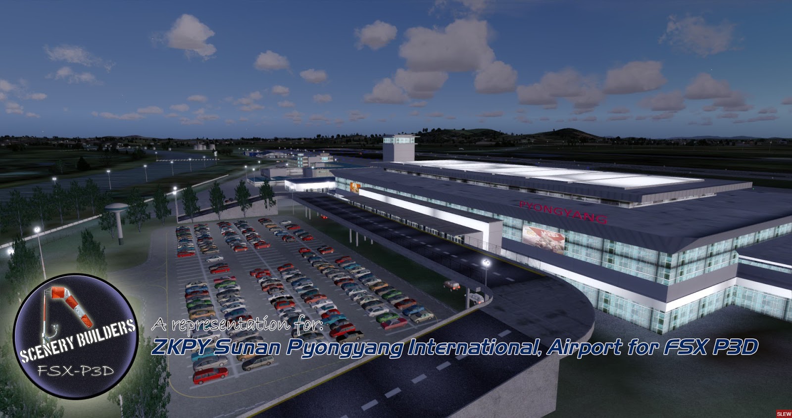
ZKPY Sunan Pyongyang International Airport FSX P3D
https://skyvector.com/airport/ZKPY/Pyongyang-Airport
Pyongyang International Airport (IATA: FNJ, ICAO: ZKPY), also known as the Pyongyang Sunan International Airport, is the main airport serving Pyongyang, capital of North Korea.
It is located in the city's Sunan District. By August 2018, only Air China and Air Koryo servicing in Pyongyang International Airport and the only two destination countries from Pyongyang International Airport are China and Russia.
miércoles, 26 de septiembre de 2018
KJOT-Joliet Regional FSX P3D
https://www.airnav.com/airport/KJOT
Joliet Regional Airport (IATA: JOT, ICAO: KJOT, FAA LID: JOT) is a public use airport located four nautical miles (7 km) west of the central business district of Joliet, a city in Will County, Illinois, United States.
It is owned by the Joliet Park District.
The airport is also 37 miles (60 kilometers) southwest of Chicago.
It opened in April 1930.
jueves, 20 de septiembre de 2018
MDSD Las Americas FSX P3D
https://airportnavfinder.com/airport/MDSD/
Las Américas International Airport (Spanish: Aeropuerto Internacional Las Américas, or AILA) (IATA: SDQ, ICAO: MDSD) is an international airport located in Punta Caucedo, near Santo Domingo and Boca Chica in the Dominican Republic.
The airport is run by Aeropuertos Dominicanos Siglo XXI (AERODOM), a private corporation based in the Dominican Republic under a 25-year concession to build, operate, and transfer (BOT) six of the country's airports.
Las Américas usually receives a wide variety of long-, mid- and short-haul aircraft.
jueves, 13 de septiembre de 2018
KLOT-Lewis University Chicago-Romeoville, Illinois FSX P3D
https://www.airnav.com/airport/KLOT
Lewis University Airport (IATA: LOT, ICAO: KLOT, FAA LID: LOT) is a public airport located 20 miles (32 km) southwest of Chicago, in the village of Romeoville in Will County, Illinois, United States.
The Joliet Regional Port District assumed ownership of the airport in 1989.
The National Weather Service Chicago, Illinois (Chicago Forecast Office) is adjacent to the airport.
miércoles, 5 de septiembre de 2018
KALO Waterloo Regional Iowa Airport FSX P3D
KALO Waterloo Regional Airport FSX P3D
https://www.airnav.com/airport/KALO
Waterloo Regional Airport (IATA: ALO, ICAO: KALO, FAA LID: ALO), also known as Livingston Betsworth Field, is a city owned public use airport located four miles (6 km)
northwest of the central business district of Waterloo, a city in Black Hawk County, Iowa, United States.
It is mostly used for general aviation and is also served by one commercial airline.
jueves, 30 de agosto de 2018
SEQM Mariscal Sucre FSX P3D
https://skyvector.com/airport/SEQM/Quito-Mariscal-Sucre-International-Airport
Mariscal Sucre International Airport (Spanish: Aeropuerto Internacional Mariscal Sucre) (IATA: UIO, ICAO: SEQM) is the busiest airport in Ecuador and one of the busiest airports in South America.
It is located in the Tababela parish, about 18 kilometres (11 mi) east of Quito and serves as the largest hub of TAME, the flag carrier of Ecuador, with an average of over 220 weekly flights.
It opened in February 2013 and replaced the old Mariscal Sucre International Airport.
lunes, 13 de agosto de 2018
KCID The Eastern Iowa Airport FSX P3D
https://www.airnav.com/airport/KCID
The Eastern Iowa Airport (IATA: CID, ICAO: KCID, FAA LID: CID) is a commercial airport in Cedar Rapids, Iowa, United States, on Wright Brothers Boulevard on the south edge of town, about two miles west of Interstate 380.
CID covers 3,288 acres (1,331 ha)
https://www.airnav.com/airport/KCID
The Eastern Iowa Airport (IATA: CID, ICAO: KCID, FAA LID: CID) is a commercial airport in Cedar Rapids, Iowa, United States, on Wright Brothers Boulevard on the south edge of town, about two miles west of Interstate 380.
CID covers 3,288 acres (1,331 ha)


