
Covering the little and forgotten areas. This is a representation for those airports, all the spare info are compiled from Google, that´s why no one has to try to make it before, (no accurate textures and sizes) seasonals textures, triple autoinstaller for FSX, P3D3, P3Dv4, P3D5 and MSFS, screenshots, seasonals textures, photoreal terrain (for the field only), autogen, custom building, new ground lights and moving jetways.
jueves, 30 de agosto de 2018
SEQM Mariscal Sucre FSX P3D
https://skyvector.com/airport/SEQM/Quito-Mariscal-Sucre-International-Airport
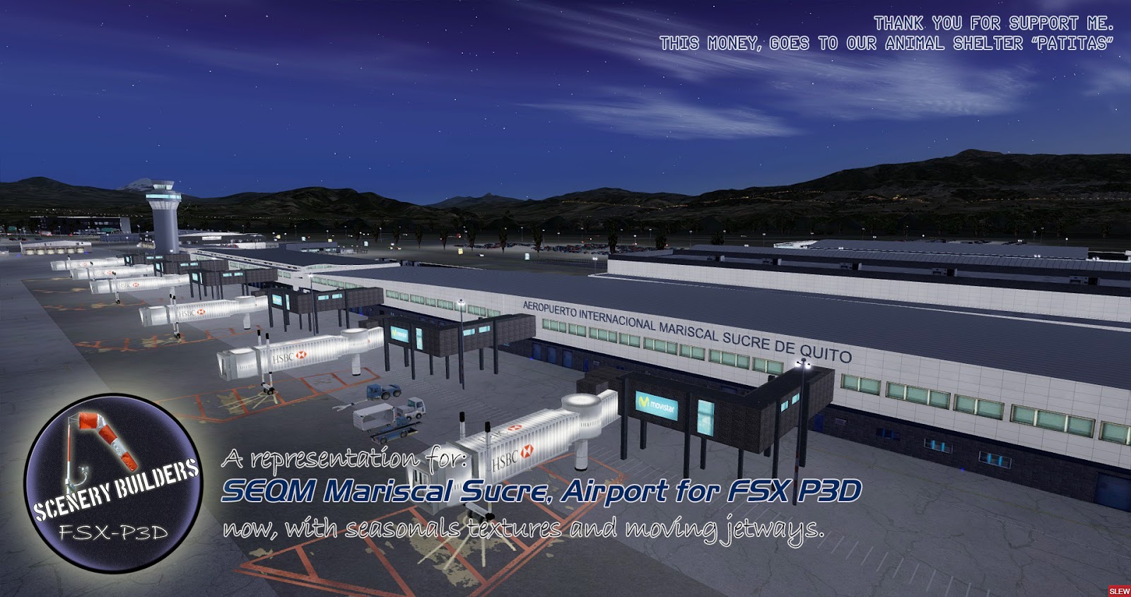
Mariscal Sucre International Airport (Spanish: Aeropuerto Internacional Mariscal Sucre) (IATA: UIO, ICAO: SEQM) is the busiest airport in Ecuador and one of the busiest airports in South America.
It is located in the Tababela parish, about 18 kilometres (11 mi) east of Quito and serves as the largest hub of TAME, the flag carrier of Ecuador, with an average of over 220 weekly flights.
It opened in February 2013 and replaced the old Mariscal Sucre International Airport.
lunes, 13 de agosto de 2018
KCID The Eastern Iowa Airport FSX P3D
https://www.airnav.com/airport/KCID
The Eastern Iowa Airport (IATA: CID, ICAO: KCID, FAA LID: CID) is a commercial airport in Cedar Rapids, Iowa, United States, on Wright Brothers Boulevard on the south edge of town, about two miles west of Interstate 380.
CID covers 3,288 acres (1,331 ha)
https://www.airnav.com/airport/KCID
The Eastern Iowa Airport (IATA: CID, ICAO: KCID, FAA LID: CID) is a commercial airport in Cedar Rapids, Iowa, United States, on Wright Brothers Boulevard on the south edge of town, about two miles west of Interstate 380.
CID covers 3,288 acres (1,331 ha)
sábado, 4 de agosto de 2018
KBIL Billings Logan International Airport FSX P3D
https://www.airnav.com/airport/KBIL
Billings Logan International Airport (IATA: BIL, ICAO: KBIL, FAA LID: BIL) is two miles northwest of downtown Billings, in Yellowstone County, Montana.
It is the second largest airport in Montana, having been surpassed by Bozeman in both number of gates as well as annual enplanements in recent years, and is owned by the city of Billings.
The airport is on top of the Rims, a 500-foot (150 m) cliff overlooking the downtown core. BIL covers 2,300 acres (9.3 km2.) of land
domingo, 29 de julio de 2018
DXXX Lomé–Tokoin Airport FSX P3D
Lomé–Tokoin Airport (IATA: LFW, ICAO: DXXX), also known as Gnassingbé Eyadéma International Airport, is an airport in Lomé, the capital of Togo.
In 2014, the airport served 616,800 passengers.
ASKY Airlines, a subsidiary of Ethiopian Airlines, has had its hub at the airport since January 2010.
A new terminal at the airport opened in early 2016, and will allow for service for up to 2 million passengers annually.
martes, 24 de julio de 2018
KBGR Bangor International Airport FSX P3D
https://www.airnav.com/airport/KBGR
Bangor International Airport (IATA: BGR, ICAO: KBGR, FAA LID: BGR) is a joint civil-military public airport on the west side of the city of Bangor, in Penobscot County, Maine, United States.
Owned and operated by the City of Bangor, the airport has a single runway measuring 11,440 by 200 ft (3,487 by 61 m). Formerly a military installation known as Dow Air Force Base, Bangor International Airport remains home to the 101st Air Refueling Wing of the Maine Air National Guard, although most of the Air Force's aircraft and personnel left in the late 1960s. BGR covers 2,079 acres (841 ha) of land.
The airport owes its prosperity to its location on major air corridors between Europe and the East Coast of the United States.
martes, 10 de julio de 2018
KAZO Kalamazoo Battle Creek International Airport FSX P3D
https://www.airnav.com/airport/KAZO
Kalamazoo/Battle Creek International Airport (IATA: AZO, ICAO: KAZO, FAA LID: AZO) is a county-owned public airport 3 miles (4.8 km) southeast of Kalamazoo, in Kalamazoo County, Michigan, USA.
The airport is located approximately 20 miles (32 km) west of the city of Battle Creek. It is included in the Federal Aviation Administration (FAA) National Plan of Integrated Airport Systems
for 2017–2021, in which it is categorized as a non-hub primary commercial service facility.
domingo, 1 de julio de 2018
KAVL Asheville Regional Airport FSX P3D
https://www.airnav.com/airport/KAVL
Asheville Regional Airport (IATA: AVL, ICAO: KAVL, FAA LID: AVL) is a Class C airport near Interstate 26 near the town of Fletcher, 9 miles (14 km) south of downtown Asheville, in the U.S. state of North Carolina, United States.
It is owned by the Greater Asheville Regional Airport Authority.
It is included in the Federal Aviation Administration (FAA) National Plan of Integrated Airport Systems for 2017–2021, in which it is categorized as a non-hub primary commercial service facility.