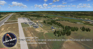
Covering the little and forgotten areas. This is a representation for those airports, all the spare info are compiled from Google, that´s why no one has to try to make it before, (no accurate textures and sizes) seasonals textures, triple autoinstaller for FSX, P3D3, P3Dv4, P3D5 and MSFS, screenshots, seasonals textures, photoreal terrain (for the field only), autogen, custom building, new ground lights and moving jetways.
jueves, 21 de septiembre de 2017
KDET Detroit Downtown FSX-P3D
KDET Detroit Downtown
https://www.airnav.com/airport/KDET
Coleman A. Young International Airport (IATA: DET, ICAO: KDET, FAA LID: DET) (Coleman A. Young Municipal Airport.
formerly Detroit City Airport until 2003) is six miles northeast of downtown Detroit, in Wayne County, Michigan.
It is owned by the City of Detroit.
The Federal Aviation Administration (FAA) National Plan of Integrated Airport Systems for 2017–2021 categorized it as a regional general aviation facility.
In 2003, it was given its current name in honor of the late former Mayor of Detroit.
viernes, 15 de septiembre de 2017
KLPR Lorain County regional FSX-P3D
KLPR Lorain County regional
https://www.airnav.com/airport/KLPR
Lorain County Regional Airport (IATA: LPR, ICAO: KLPR, FAA LID: LPR) is a public airport in Lorain County, Ohio, owned by the Lorain County Board of Commissioners and located in New Russia Township.
The airport is about 7 miles south of Lorain and 5 miles southwest of Elyria.
The National Plan of Integrated Airport Systems for 2011–2015 categorized it as a general aviation reliever airport.
lunes, 11 de septiembre de 2017
1rst Pensilvania regionals airports pack (4) FSX-P3D
1rst Pensilvania regionals airports pack (4) FSX-P3D
1-KWAY-Greene County Airport
Greene County Airport (IATA: WAY, ICAO: KWAY, FAA LID: WAY) is a county owned, public use airport in Greene County, Pennsylvania, United States.
It is located two nautical miles (4 km) east of the central business district of Waynesburg, Pennsylvania.
This airport was included in the National Plan of Integrated Airport Systems for 2009–2013, which categorized it as a general aviation facility
2-KMPO-Pocono Mountains Municipal Airport
http://www.airnav.com/airport/KMPO
3-3G1-Erie County Airport
Erie County Airport (FAA LID: 3G1) is a privately owned, public use airport in Erie County, Pennsylvania, United States.
It is located three nautical miles (6 km) northwest of the central business district of Wattsburg, Pennsylvania.
It is currently listed as abandoned on the Detroit sectional chart.
4-N57-New Garden Airport
http://www.airnav.com/airport/N57
lunes, 4 de septiembre de 2017
KSHV Shreveport LA FSX-P3D
Shreveport LA (KSHV)
http://www.airnav.com/airport/KSHV
Shreveport Regional Airport (IATA: SHV, ICAO: KSHV, FAA LID: SHV) is a public use airport in Shreveport, Louisiana, United States.
It is owned by the City of Shreveport and located four nautical miles (7 km) southwest of its central business district.
The airport's runways and terminal are visible to traffic along Interstate 20, a main east-west corridor of the Southern United States.
Shreveport Regional was designed to replace the Shreveport Downtown Airport, which limited growth due to close proximity of the Red River.
lunes, 21 de agosto de 2017
KCRP Corpus Christi TX FSX P3D
Corpus Christi TX (KCRP)
http://www.airnav.com/airport/KCRP
Corpus Christi International Airport (IATA: CRP, ICAO: KCRP, FAA LID: CRP) is a city-owned public-use airport five nautical miles (9 km) west of the central business district of Corpus Christi, in Nueces County, Texas, United States.
The airport's six-gate 165,000 sq ft (15,300 m2) Hayden W. Head Terminal, designed by Gensler, opened on November 3, 2002 with a theme of "When the Sun Meets the Sea.
miércoles, 16 de agosto de 2017
MZBZ Philip S. W. Goldson International
MZBZ Philip S. W. Goldson International
https://skyvector.com/airport/MZBZ/Philip-S-W-Goldson-International-Airport
Philip S. W. Goldson International Airport (IATA: BZE, ICAO: MZBZ) is an airport that serves the nation of Belize's largest city, Belize City along the eastern coast of Central America. It was named
after politician Philip Stanley Wilberforce Goldson, who died in the year 2001.
jueves, 10 de agosto de 2017
KPIT Pittsburgh International Airport FSX-P3D
KPIT Pittsburgh International Airport
https://www.airnav.com/airport/kpit
Pittsburgh International Airport (IATA: PIT, ICAO: KPIT, FAA LID: PIT), formerly Greater Pittsburgh International Airport, is a civil–military international airport in the suburbs of the United States' city of Pittsburgh, Pennsylvania.
It is located in Findlay and Moon townships of Allegheny County, about 20 miles (30 km) west of downtown Pittsburgh.


