KDAY James M Cox Dayton International Airport FSX P3D
https://www.airnav.com/airport/KDAY
Dayton International Airport (IATA: DAY, ICAO: KDAY, FAA LID: DAY) (officially James M. Cox Dayton International Airport), formerly Dayton Municipal Airport and James M. Cox-Dayton Municipal Airport, is ten miles north of downtown Dayton, in Montgomery County, Ohio.
The airport is within the city limits of Dayton, in an exclave of Dayton
not contiguous with the rest of the city.
Its address is 3600
Terminal Drive, Dayton, Ohio 45377.
The airport is headquarters for American Eagle carrier PSA Airlines.

Covering the little and forgotten areas. This is a representation for those airports, all the spare info are compiled from Google, that´s why no one has to try to make it before, (no accurate textures and sizes) seasonals textures, triple autoinstaller for FSX, P3D3, P3Dv4, P3D5 and MSFS, screenshots, seasonals textures, photoreal terrain (for the field only), autogen, custom building, new ground lights and moving jetways.
jueves, 14 de junio de 2018
miércoles, 6 de junio de 2018
KGON Groton-New London airport FSX P3D
KGON Groton-New London airport FSX P3D
https://www.airnav.com/airport/KGON
Groton–New London Airport (IATA: GON, ICAO: KGON, FAA LID: GON) is a state owned, public use airport located three nautical miles (6 km) southeast of the central business district of Groton, a town in New London County,
Connecticut, United States.
It is included in the Federal Aviation Administration (FAA) National Plan of Integrated Airport Systems for 2017–2021, in which it is categorized as a regional general aviation facility.
It serves the southeastern Connecticut region, including the shoreline localities of Groton, New London, and Mystic.
lunes, 28 de mayo de 2018
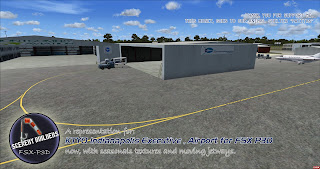
KTYQ Indianapolis Executive airport FSX P3D
KTYQ Indianapolis Executive airport FSX P3D
https://airnav.com/airport/KTYQ
Indianapolis Executive Airport (ICAO: KTYQ, FAA LID: TYQ) is a public airport at 11329 E. State Road 32, five miles north of Zionsville, just west of Jolietville in Boone County, Indiana, United States.
The airport is owned by the Hamilton County Airport Authority. It is 14 miles (23 km) northwest of downtown Indianapolis and is a reliever airport for Indianapolis International Airport.
miércoles, 23 de mayo de 2018
KGSO, Piedmont Triad International Airport FSX P3D
KGSO, Piedmont Triad International Airport FSX P3D
https://www.airnav.com/airport/KGSO
Piedmont Triad International Airport (IATA: GSO, ICAO: KGSO, FAA LID: GSO) (commonly referred to as "PTI") is an airport located in the center of North Carolina just west of Greensboro,
serving Greensboro, High Point and Winston-Salem as well as the entire Piedmont Triad region in North Carolina.
The airport, located just off Bryan Boulevard, sits on a 3,770 acre (1,526 ha) campus and has 3 runways.
Piedmont Triad International airport is the third busiest airport in North Carolina averaging 280 takeoffs and landings each day.
PTI is owned and operated by the Piedmont Triad Airport Authority.
viernes, 11 de mayo de 2018
KDLH Duluth International Airport FSX P3D
KDLH Duluth International Airport FSX P3D
https://www.airnav.com/airport/KDLH
Duluth International Airport (IATA: DLH, ICAO: KDLH, FAA LID: DLH) is a city-owned, public-use joint civil-military airport located five nautical miles (9 km) northwest of the central
business district of Duluth, a city in Saint Louis County, Minnesota, United States.
It serves the Twin Ports area, including Superior, Wisconsin. Mostly used for general aviation but also served by three airlines, it is Minnesota's third-busiest airport, behind
Minneapolis–St. Paul International Airport (MSP) and Rochester International Airport
http://duluthairport.com/
viernes, 4 de mayo de 2018
KAOO - Altoona–Blair County Airport FSX P3D
KAOO - Altoona–Blair County Airport FSX P3D
https://www.airnav.com/airport/KAOO
Altoona–Blair County Airport (IATA: AOO, ICAO: KAOO, FAA LID: AOO) is a county owned, public airport in Martinsburg, Pennsylvania, 14 miles south of Altoona, in Blair County, Pennsylvania.
It is owned by the Blair County Airport Authority.
The airport has a few airline flights, subsidized by the Essential Air Service program.
miércoles, 25 de abril de 2018
KSHD-Shenandoah Valley Regional Airport FSX-P3D
KSHD-Shenandoah Valley Regional Airport FSX-P3D
http://www.airnav.com/airport/KSHD
Shenandoah Valley Regional Airport (IATA: SHD, ICAO: KSHD, FAA LID: SHD) is a public airport located in Weyers Cave, Virginia; 10 nautical miles (12 mi, 19 km) northeast of the central business district of Staunton.
It is mostly used for general aviation, but is also served by one commercial airline. Service is subsidized by the Essential Air Service program.
The airport is operated by the Shenandoah Valley Regional Airport Commission, which consists of members from the cities of Staunton, Waynesboro and Harrisonburg, and the counties of Augusta and Rockingham.


