Covering the little and forgotten areas. This is a representation for those airports, all the spare info are compiled from Google, that´s why no one has to try to make it before, (no accurate textures and sizes) seasonals textures, triple autoinstaller for FSX, P3D3, P3Dv4, P3D5 and MSFS, screenshots, seasonals textures, photoreal terrain (for the field only), autogen, custom building, new ground lights and moving jetways.
martes, 19 de diciembre de 2017
KGFK Grand Forks, ND FSX-P3D
KGFK Grand Forks, ND FSX-P3D
http://www.airnav.com/airport/KGFK
Grand Forks International Airport (IATA: GFK, ICAO: KGFK, FAA LID: GFK) is a public airport five miles (8 km) northwest of Grand Forks, in Grand Forks County, North Dakota.
GFK has no scheduled passenger flights out of the country but has an "international" title (like many other airports) because it has customs service for arrivals from Canada and other countries.
viernes, 15 de diciembre de 2017
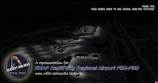
KRAP Rapid City Regional Airport FSX-P3D
KRAP Rapid City Regional Airport FSX-P3D
http://www.airnav.com/airport/KRAP
Rapid City Regional Airport (IATA: RAP, ICAO: KRAP, FAA LID: RAP) is a public use airport, nine miles southeast of Rapid City, in Pennington County, South Dakota.
It is included in the Federal Aviation Administration (FAA) National Plan of Integrated Airport Systems for 2017–2021, in which it is categorized as a non-hub primary commercial service facility.
viernes, 8 de diciembre de 2017
KBIS Bismarck FSX P3D
KBIS Bismarck, ND
https://www.airnav.com/airport/KBIS
Bismarck Municipal Airport (IATA: BIS, ICAO: KBIS, FAA LID: BIS) is in Burleigh County, North Dakota,three miles southeast of the City of Bismarck, North Dakota, which owns it.
The National Plan of Integrated Airport Systems for 2011–2015 categorized it as a primary commercial service airport
martes, 5 de diciembre de 2017
KEWN Craven County Regional Airport FSX P3D
KEWN Craven County Regional Airport
https://www.airnav.com/airport/EWN
Coastal Carolina Regional Airport (IATA: EWN, ICAO: KEWN, FAA LID: EWN) is a public airport located three miles (5 km) southeast of central business
district of New Bern, a town in Craven County, North Carolina, United States.
Coastal Carolina Regional Airport serves four counties in Eastern North Carolina.
They include Craven County, Pamlico County, Carteret County, and Jones County.
miércoles, 29 de noviembre de 2017
KLAM Los Alamos, NM FSX-P3D
KLAM Los Alamos, NM, FSX-P3D
https://www.airnav.com/airport/KLAM
Los Alamos Airport(IATA: LAM, ICAO: KLAM, FAA LID: LAM), also known as Los Alamos County Airport, is a county owned, public use airport in Los Alamos County, New Mexico, United States.
It is located one nautical mile (2 km) east of the central business district of Los Alamos, New Mexico.
This airport is included in the National Plan of Integrated Airport Systems for 2011–2015, which categorized it as a general aviation facility
domingo, 26 de noviembre de 2017
KGTF Great Falls International Airport FSX-P3D
KGTF Great Falls International Airport
http://www.airnav.com/airport/KGTF
Not to be confused with Grand Falls Airport.
Great Falls International Airport (former Great Falls Army Airfield)
IATA: GTF ICAO: KGTF FAA LID: GTF
martes, 7 de noviembre de 2017
KSUX Sioux City, IA FSX-P3D
KSUX Sioux City, IA
http://www.airnav.com/airport/KSUX
"SUX" redirects here. For other uses, see Sux (disambiguation).
For the United States Air Force use of the facility, see Sioux City Air National Guard Base.
IATA: SUX ICAO: KSUX FAA LID: SUX
miércoles, 25 de octubre de 2017
KOAK Metropolitan Oakland International Airport fsx-p3d
KOAK Metropolitan Oakland International Airport
https://www.airnav.com/airport/KOAK
Oakland International Airport (IATA: OAK, ICAO: KOAK, FAA LID: OAK) is an international airport in Oakland, California, United States.
It is located approximately 10 miles south of Downtown. It is owned by the Port of Oakland.
The airport has passenger service to cities in the United States, Mexico, and Europe. Cargo flights fly to cities in the United States, Canada, and Japan.
martes, 17 de octubre de 2017
KHFY Greenwood Municipal Airport FSX-P3D
KHFY Greenwood Municipal Airport FSX-P3D
https://www.airnav.com/airport/KHFY
Indy South Greenwood Airport (ICAO: KHFY, FAA LID: HFY) (previously Greenwood Municipal Airport) is a city owned public use airport in Greenwood, a city in Johnson County, Indiana, United States.
It is 10 miles (16 km) southeast of Indianapolis.


